Lightweight Metadata‑Aware Mixture‑of‑Experts MAE for EO
Pre‑train a lightweight MoE‑MAE for Earth Observation and fine‑tune it for downstream EO tasks.
Google Cloud ML Engineer · Python Expert · AI for EO · Cloud‑native geospatial

Pre‑train a lightweight MoE‑MAE for Earth Observation and fine‑tune it for downstream EO tasks.
Use CLAY embeddings to detect flood‑induced changes from Sentinel‑1 and Sentinel‑2 data.
Deploy and manage STAC catalog components using a simple, reproducible Docker Compose setup.
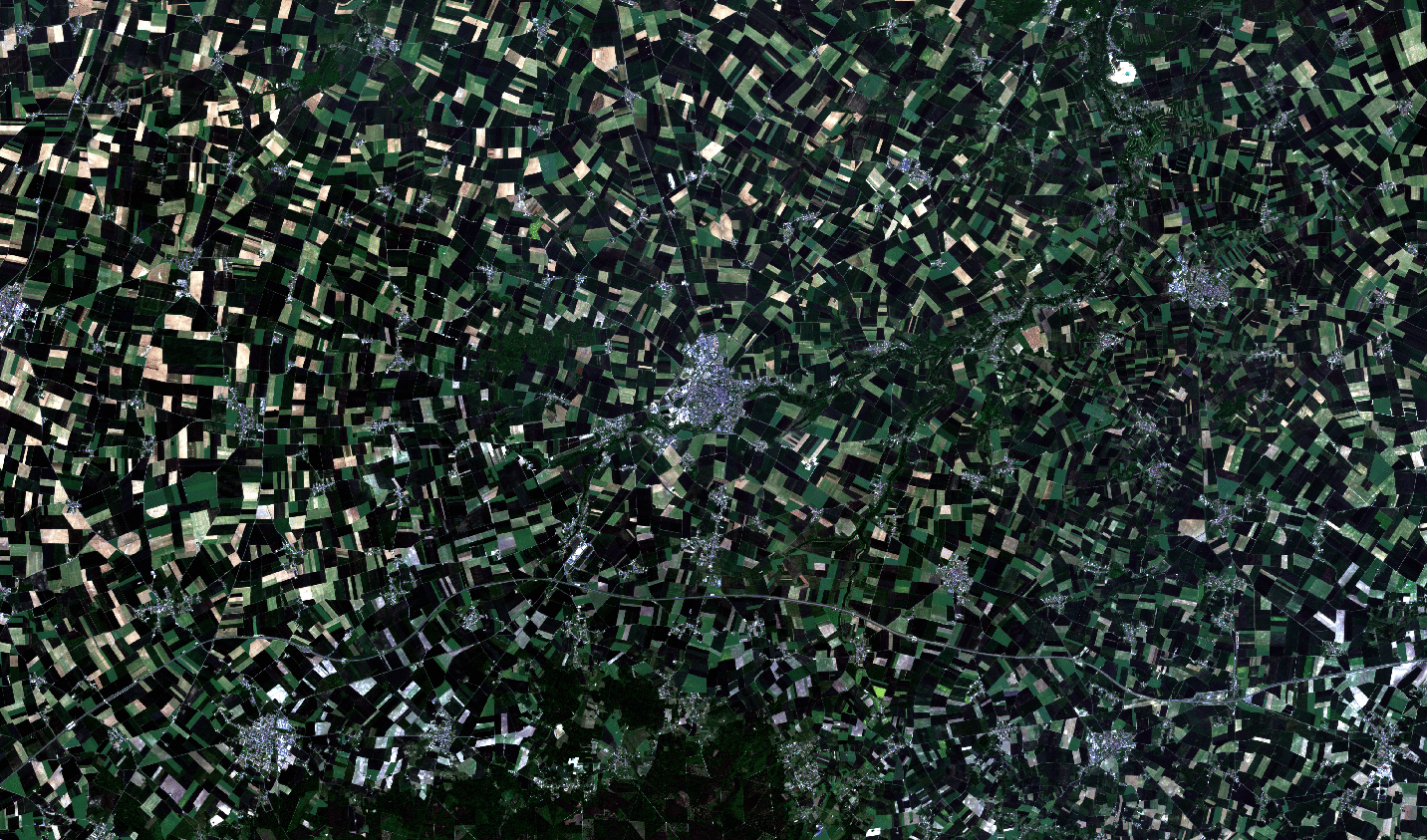
Enhance Sentinel‑2 imagery to 5 m resolution using learning‑based super‑resolution.
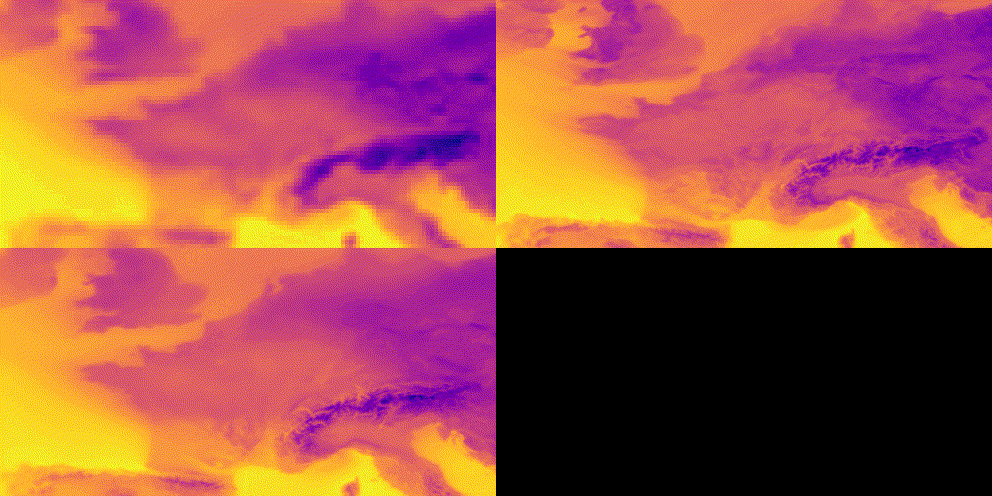
Super‑resolve ERA‑5 temperature fields to match CERRA spatial resolution.
Super‑resolve ERA‑5 wind speed fields to match CERRA spatial resolution.
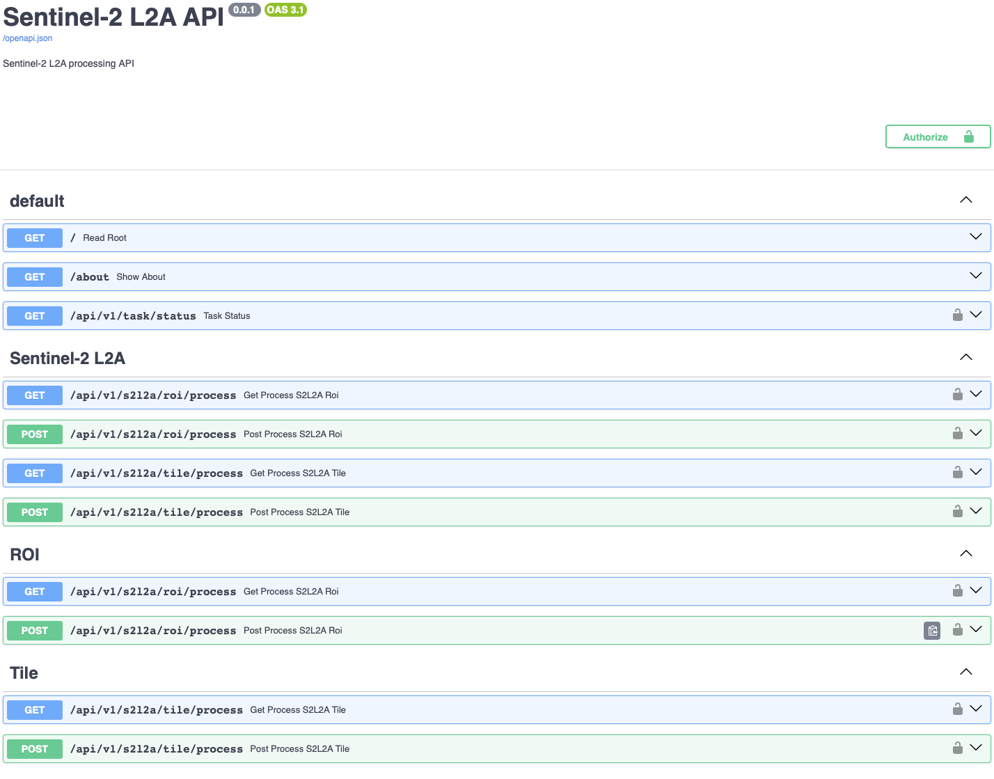
Cloud‑native API with Docker, Kubernetes, Celery, Redis, and Flower to download and process Sentinel‑2 imagery.
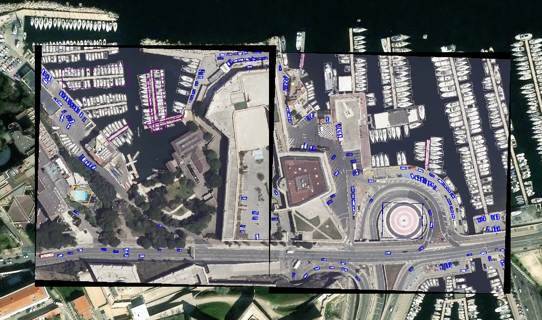
Oriented bounding box (OBB) detection with YOLOv8 for very‑high‑resolution remote sensing imagery.
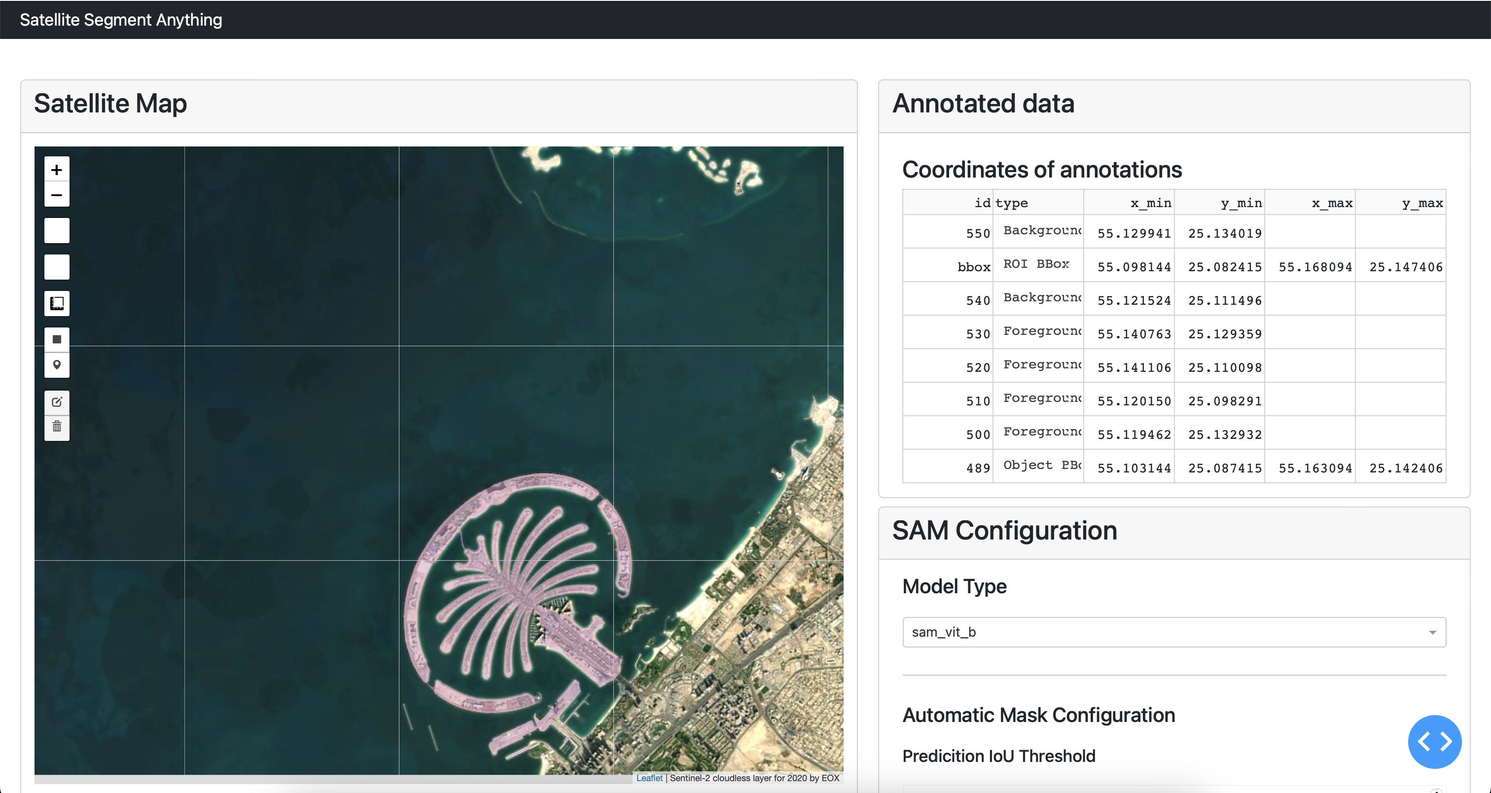
Interactive segmentation dashboard for Sentinel‑2 imagery using Segment Anything (SAM).
Adapt SAM foundation model for downstream remote sensing tasks via efficient fine‑tuning.
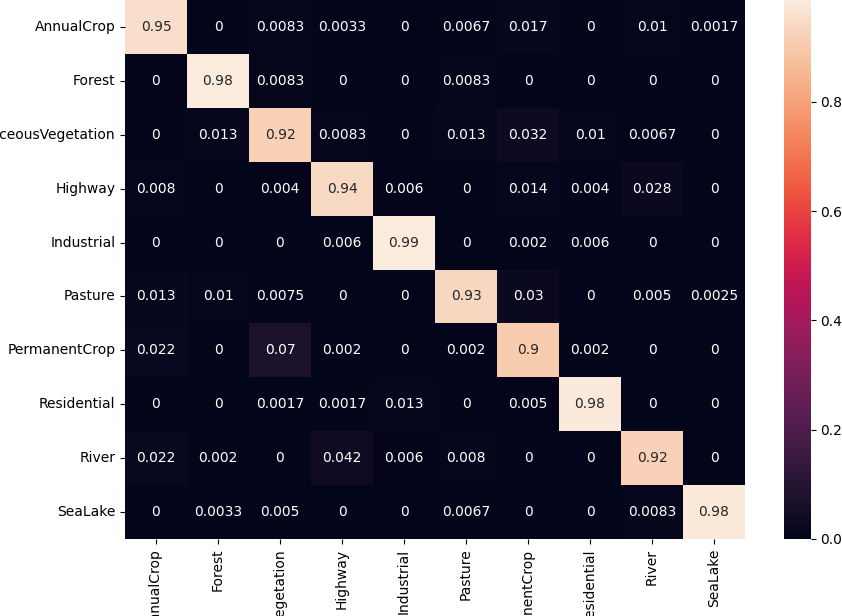
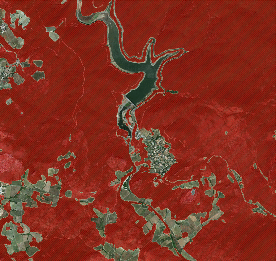
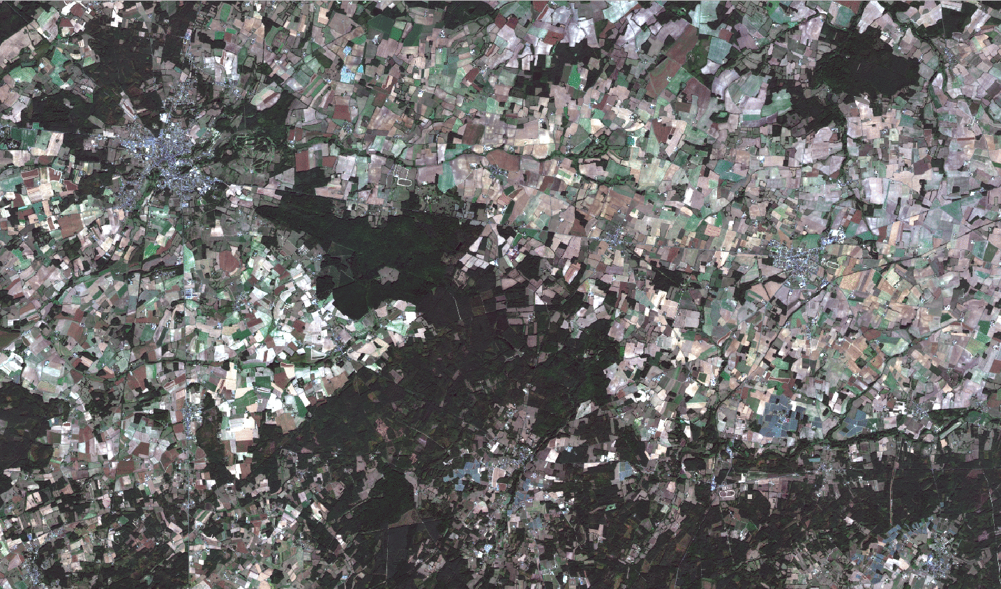
Deep‑learning approach to extract agricultural field boundaries for precision agriculture.
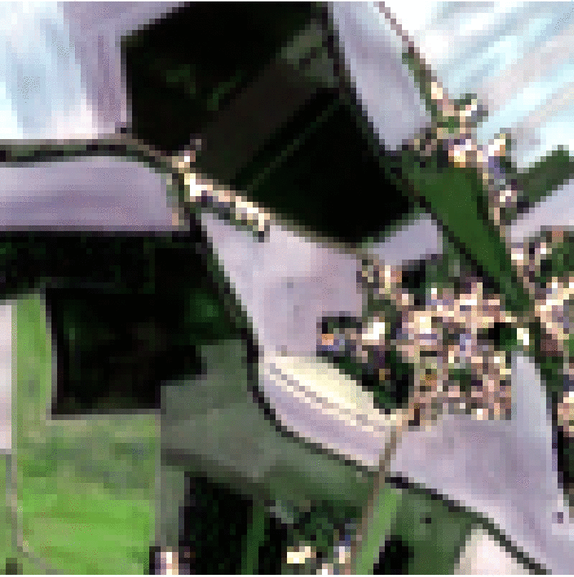
Enhance Sentinel‑2 imagery to 2.5 m resolution using super‑resolution techniques.
Map fire‑risk zones with deep learning and aerial/satellite imagery to support disaster management.
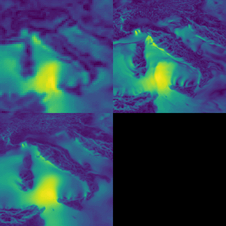
Fast, scalable estimation of Leaf Area Index (LAI) over large areas using deep learning.
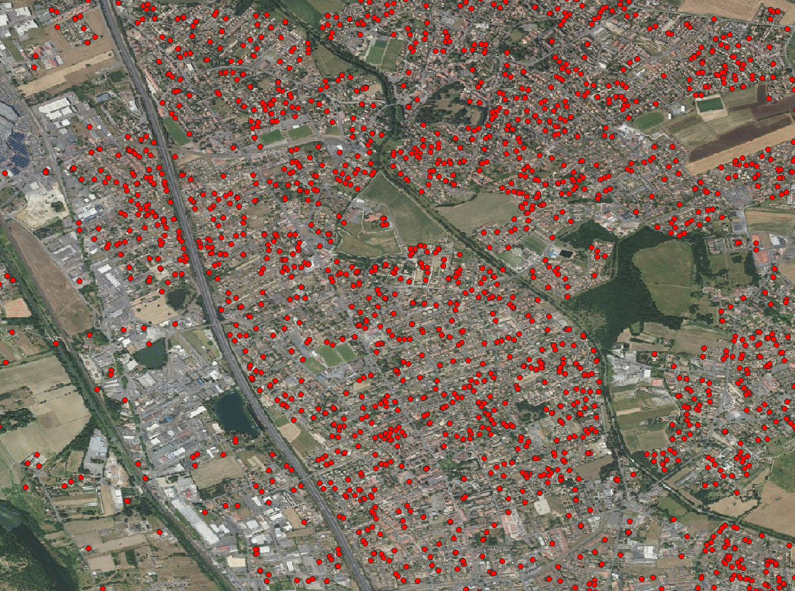
Detect swimming pools across French communes to support circular‑economy initiatives.