MEOX: compact multimodal EO with experts
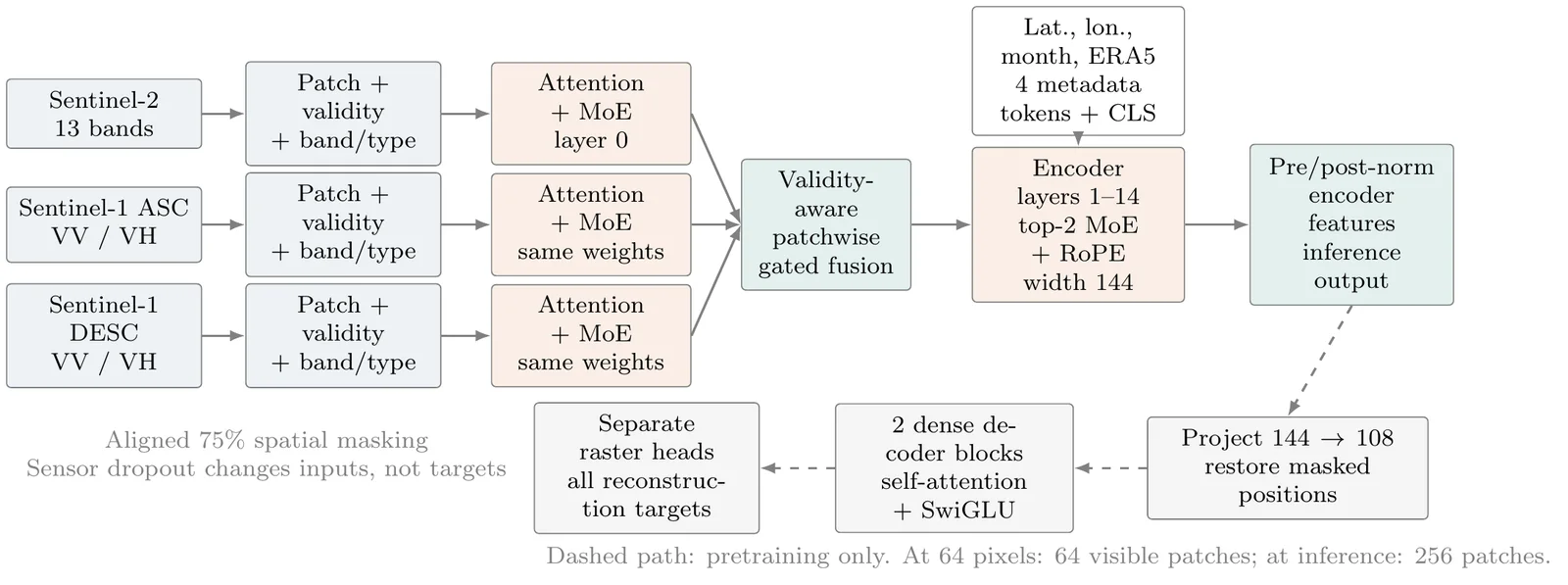
A validity-aware masked autoencoder that fuses Sentinel-2, ascending and descending Sentinel-1, and environmental metadata while remaining compact enough for practical experimentation.
I’m Mohanad, a machine-learning scientist turning satellite and climate data into useful, scalable systems—from foundation models to production geospatial platforms.
A selection of research, engineering and teaching across foundation models, forecasting, computer vision, AI assistants and geospatial infrastructure.
A validity-aware masked autoencoder that fuses Sentinel-2, ascending and descending Sentinel-1, and environmental metadata while remaining compact enough for practical experimentation.
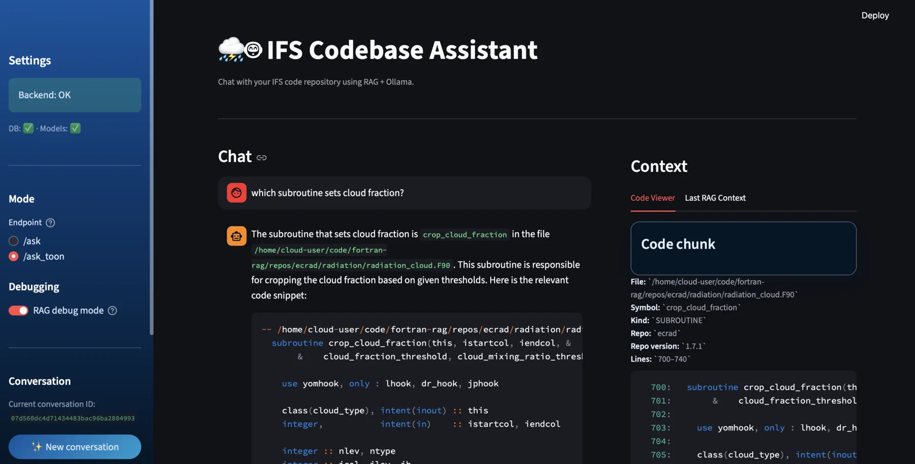
A full-stack assistant for navigating large Fortran-centric repositories, combining structure-aware parsing, hybrid retrieval, reranking, cited answers and an inspectable source-code interface.
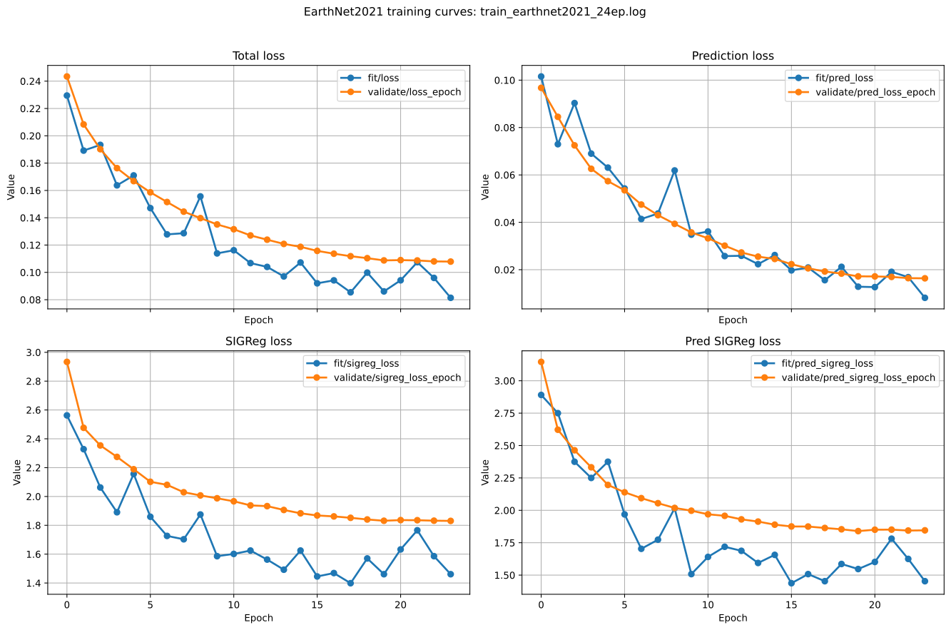
An Earth Observation adaptation of LeWorldModel trained on 717,120 EarthNet2021 steps. Its learned dynamics beat persistence for latent forecasting across validation, IID, OOD and extreme splits.
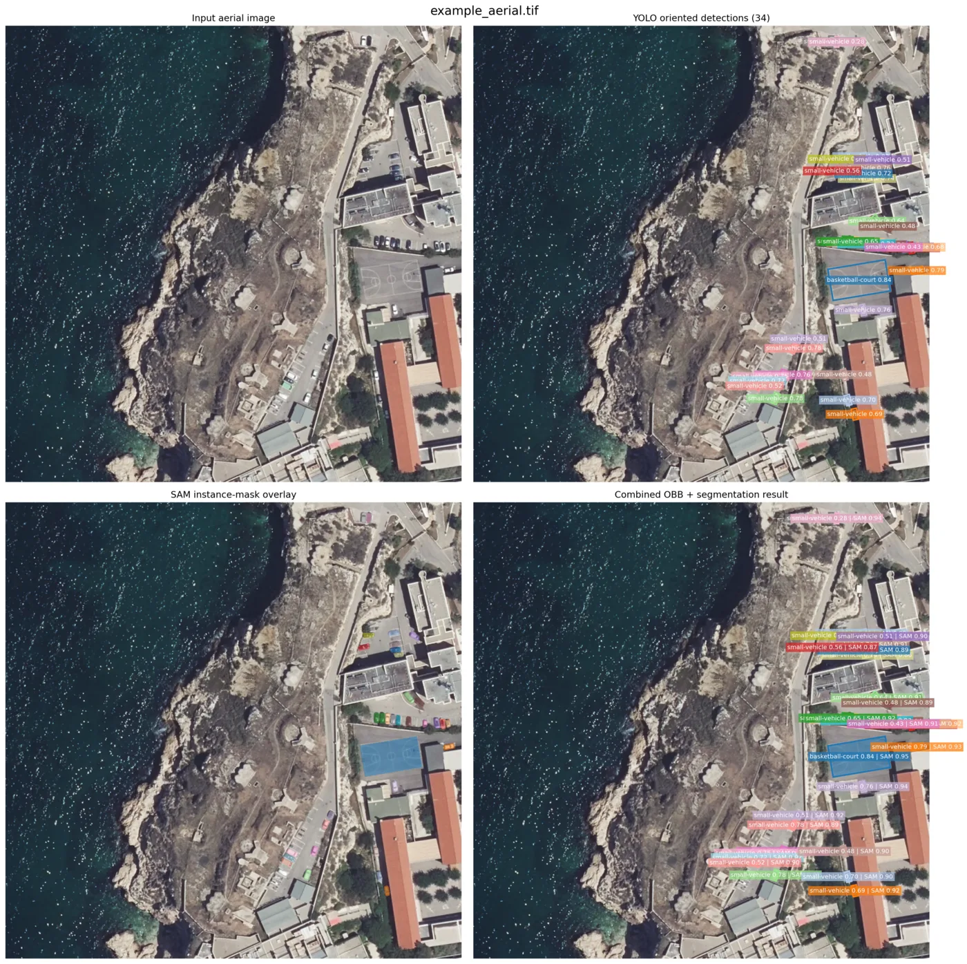
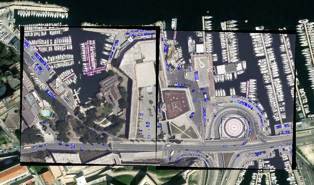
A local two-stage workflow that detects oriented objects, prompts SAM with each result, and clips the final instance masks back to the detected geometry.
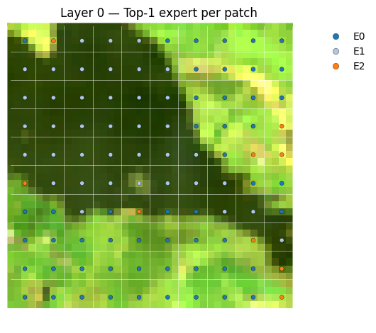
A lightweight pre-training architecture that routes Earth Observation data through specialised experts before adaptation to downstream tasks.
Sentinel-1 and Sentinel-2 representations reveal flood-driven landscape change without a task-specific feature extractor.
A reproducible Docker Compose stack for making geospatial collections searchable and interoperable.
Learning-based enhancement of Sentinel-2 imagery toward VENµS spatial detail.
Downscaling global ERA5 temperature fields toward the regional detail of CERRA data.
Recovering finer regional structure from coarse wind-speed fields with deep learning.
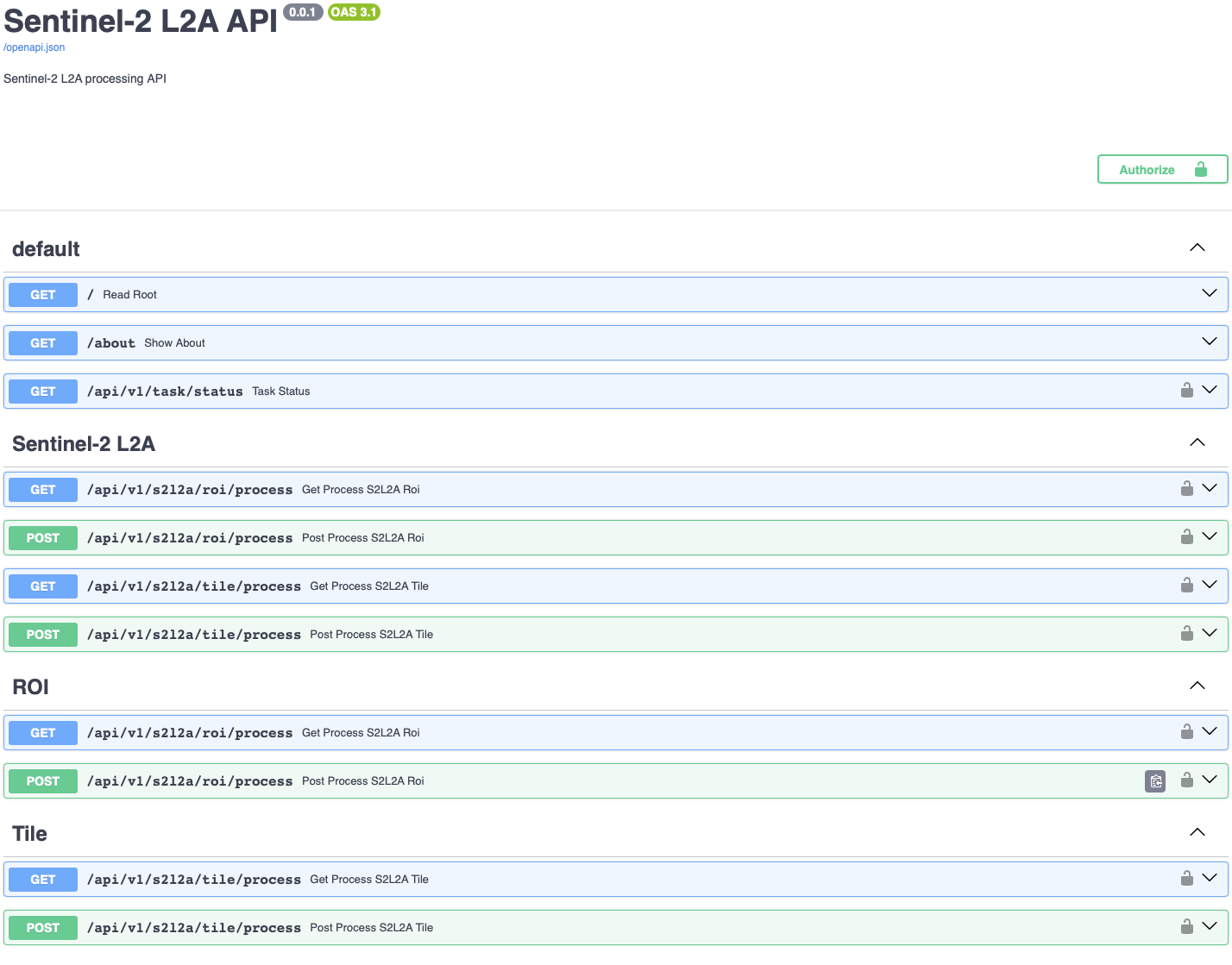
Scalable imagery processing with Docker, Kubernetes, Celery, Redis and Flower.
YOLOv8 oriented bounding boxes for objects in very-high-resolution satellite and aerial imagery.
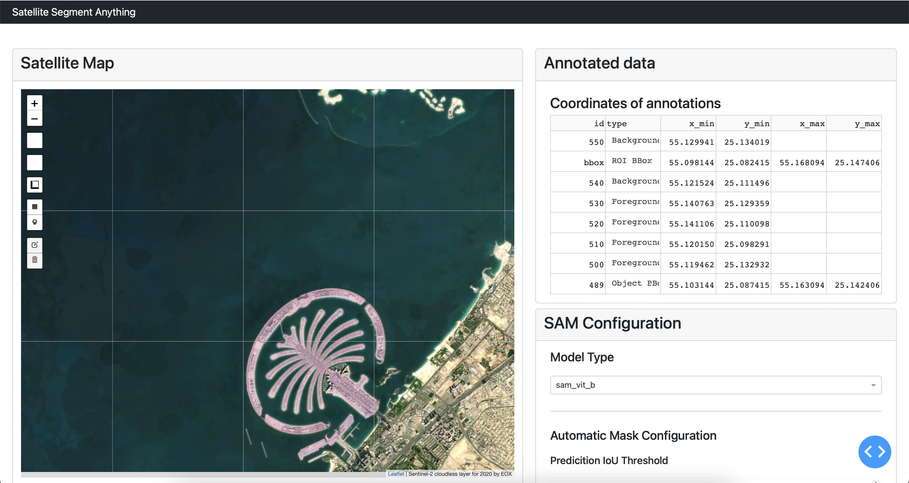
An interactive dashboard that brings Segment Anything workflows to satellite imagery.
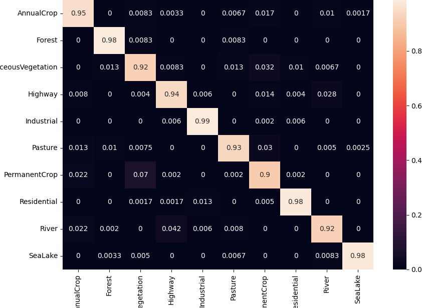
Efficient fine-tuning strategies for specialised downstream segmentation tasks.
Deep-learning extraction of agricultural parcel boundaries from Sentinel-2 imagery.
Super-resolving multispectral observations to 2.5 m for more detailed analysis.
Deep-learning maps of vulnerable zones to support planning and disaster management.
Fast estimation of Leaf Area Index over large areas from Sentinel-2 observations.
Automated detection across French communes to support circular-economy initiatives.
Zero2Hero Tutor and Challenge Tutor for a five-day hands-on programme on AI for Earth systems, hazards and climate extremes.
Practical workshop material for exploring Earth Observation data and cloud-native geospatial workflows.
Hands-on material connecting artificial intelligence and digital twins, alongside ECMWF training on processing Earth Observation data in cloud environments.
An introductory tutorial on accessing and applying EO4EU resources for Earth Observation workflows.
Hands-on training covering machine learning with cultivated-parcel data and machine and deep learning for Sentinel-2 imagery.
A practical guide to building reproducible machine-learning pipelines for geospatial applications.
Contributor to a half-day tutorial and hands-on session on AI4Copernicus tools for connecting artificial intelligence with Earth Observation applications.
I work across the full path from research question to maintainable service, with a focus on systems that can be understood, reproduced and used.
Computer vision and representation learning for multispectral, radar, aerial and climate data.
APIs, data catalogs and scalable processing workflows that move models beyond the notebook.
Technical leadership, open training and workshops that make advanced methods practical for teams.
I’m always interested in thoughtful conversations about geospatial AI, applied research and systems that turn complex data into real-world value.